Costa da Morte · Galicia

Hórreo deCarnotastone facing the sea · Carnota, A Coruña

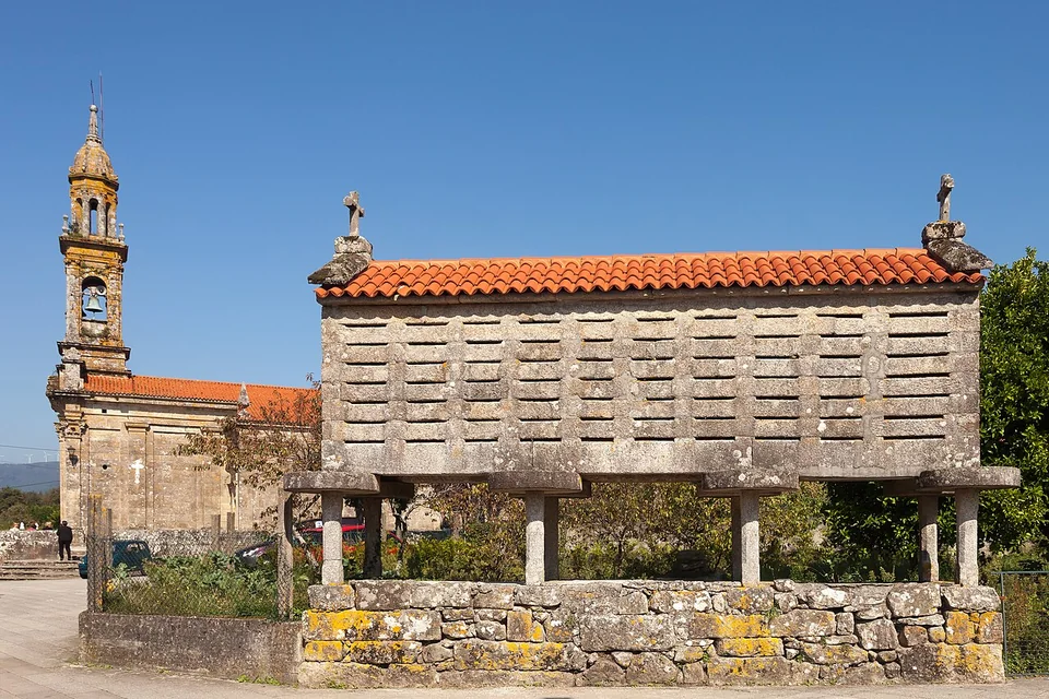
An eighteenth-century granary transformed into landscape: 34.76 metres of granite, agricultural memory and Atlantic wind in Santa Comba de Carnota.

Outdoor visitFree access
Suggested time30–60 min
Built1768
评价来自谷歌地图用户评价
4.5 5,964 Google Maps reviews

评分与评价数同步自谷歌地图(Google Maps)用户评价 · 2026 年 9 月 · 点击查看谷歌地图全部评价↗

Hórreo de Carnota - Main view in Carnota, SpainHórreo and Santa Comba church · Photo: Lmbuga · CC BY-SA 4.0
34,76metres long
1,90metres wide
22pairs of feet
1783year extended
01 / READ THE BUILDING
It is not simply a long granary. It is a precise response to Atlantic damp, a measure of harvest and a monumental piece within a religious and agricultural ensemble.

The raised chamber protects grain from damp ground and animals; horizontal slots keep air moving through the store.

Church, rectory, dovecote, threshing floor and hórreo reveal how an eighteenth-century rural parish was organised.

22 pairs of feet · 44 supports34.76 m
Useful architecture

A granite machine for drying grain

Every element responds to damp ground, rain and animals. Select a point to read the building logic.

01 / 05

Roof, finials and cross

A pitched tile roof sheds Atlantic rain. Baroque finials and the cross set on a stone sphere turn a practical storehouse into a civic landmark.

Select an element in the drawing.
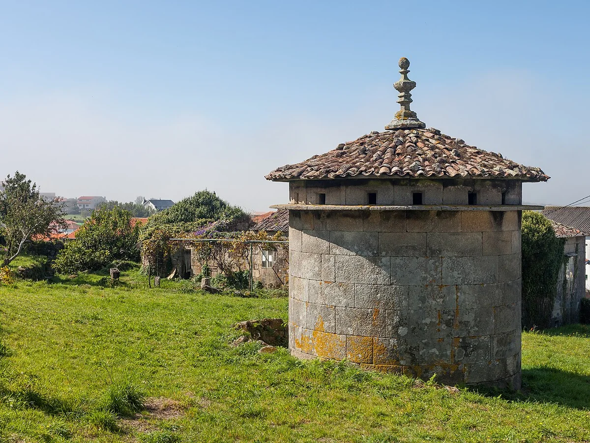
Traditional stone dovecote in CarnotaHórreoChurchRectoryDovecote · Threshing floor
An ensemble, not an isolated object

Santa Comba rewards a slow walk

The hórreo belongs to a shared historic space with the church, rectory, dovecote and threshing floor. The visit becomes richer when their relationships are read together.

01
Hórreo

A raised, ventilated and protected storehouse.

02
Church of Santa Comba

A Baroque-classicist church dated to 1755.

03
Rectory

The residence linked to parish administration.

04
Dovecote and threshing floor

Production, storage and daily life in one place.

Read the full history
Practical information

Arrive, look closely, then continue to the coast

Outdoor viewing is free. Allow thirty to sixty minutes to read the hórreo and the Santa Comba ensemble rather than treating it as a rushed photo stop.

AccessFree outdoor viewing
LocationSanta Comba de Carnota
Coordinates42.82248, −9.09057
Best lightMorning or late afternoon
On siteDo not climb or enter the chamber
42°49′21″N · 9°05′26″W

Open the exact route

The site is reached through Carnota's local road network. During busy summer periods, allow extra time to park and walk the final metres.

Start navigation
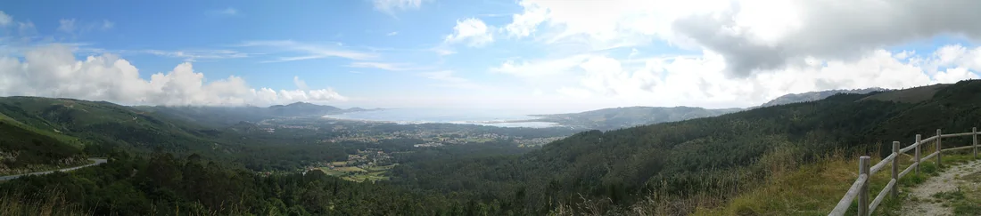
Panorama of Carnota Beach from LouredoCarnota Beach · Photo Xosema · CC BY-SA 4.0
From fields to ocean

Stone tells the story of the land. The beach tells the Atlantic.

Minutes away, Carnota Beach extends the journey across seven kilometres of sand, dunes, marsh and intertidal flats beneath Monte Pindo.

Explore nearby places
Routes that fit the day

Choose by time, not by anxiety

Three realistic plans connect architecture, coast and food without turning Carnota into a checklist.

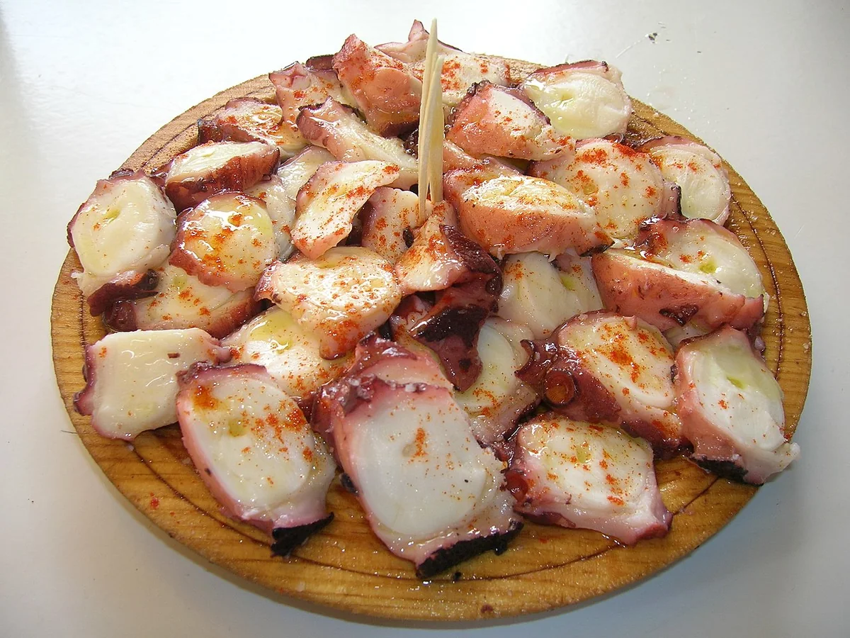
Pulpo a feira served on a wooden plate
Polbo a feira · José Antonio Gil Martínez · CC BY 2.0
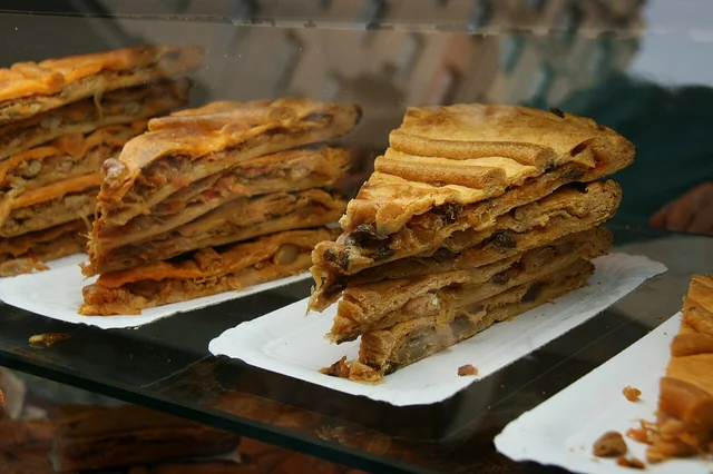
Galician empanadas
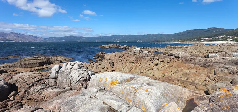
Carnota coast seen from Portocubelo
Taste the landscape

Octopus, empanada and food from the sea

The hórreo recalls the importance of maize and preservation; the coast provides octopus, fish and shellfish. Plan meals by area and confirm opening hours, especially outside summer.

We do not publish rankings or copy review scores. The guide groups venues listed by the municipality and explains which part of the route each area suits.

Open the local food guide
Hórreo de Carnota

About Hórreo de Carnota

Welcome to Hórreo de Carnota, widely recognized as the landmark known as Hórreo Carnota. Located in the heart of Carnota, A Coruña, Spain, this destination is a reference point for travellers exploring the Costa da Morte.

It is an eighteenth-century maize granary, neither a house nor a temple: monumental scale, granite craftsmanship and its position beside the Church of Santa Comba explain why it became a Galician symbol.

Map of Hórreo de Carnota in Santa Comba de Carnota · Source: Google Maps · 2026 年 9 月
History

History & significance of Hórreo de Carnota

1768

First phase with eleven pairs of feet.

1783

Extension to twenty-two pairs.

34.76 m

Final length of the granite body.

Heritage

An ensemble with church, rectory, dovecote and threshing floor.

Read the full history
Nearby

Landmarks & attractions around Hórreo Carnota

When visiting Hórreo de Carnota, visitors can easily explore surrounding historical landmarks and points of interest, including Hórreo de Lira and Carnota Beach.

01
Hórreo de Lira

Built between 1779 and 1814: 36.53 m long and 1.60 m wide on a stone platform.

02
Carnota Beach

Seven kilometres of sand, dunes and marsh beneath the Monte Pindo skyline.

03
Church of Santa Comba

A Baroque-classicist church of 1755 that shares the ensemble with the hórreo.

04
Monte Pindo

The A Moa summit reaches 627 m and needs time, navigation and clear weather.

See every nearby place
Visitor reviews

Hórreo de Carnota visitor reviews

A snapshot of public ratings for the monument. We only display the average score and total review count; the full text of every review belongs to Google Maps and its authors.

4.5 5,964 reviews 在谷歌地图查看全部评价

同步自 Google 地图用户评价,同步时间 2026 年 9 月;版权归原作者与 Google 地图所有。Snapshot note: this section shows the Google Maps rating and review-count snapshot only, not the complete review content. See Google Maps for the latest reviews.

Google 地图(Google Maps)↗

资料来源 / Sources

Sources & attributions

评价 · 同步时间 2026 年 9 月 — 同步自 Google 地图用户评价,同步时间 2026 年 9 月;版权归原作者与 Google 地图所有。原始评价数据来自 Google 地图(Google Maps)↗,点击可查看全部 5,964 条评价。

Official tourism informationCarnota Council · Official tourism portal↗ · Galicia Tourism · Carnota–Monte Pindo↗

History and visitor facts — Carnota Council, Galicia Tourism and Costa da Morte. Transport timetables and restaurant hours are checked on Bus.gal and directly with each venue.

图片 — Photographs from Wikimedia Commons under CC0, CC BY 2.0 and CC BY-SA 4.0 licences; full attribution is listed on the credits page.

Independent, unofficial guide — not affiliated with Carnota Council or Google. 本网站为独立非官方指南,与卡尔诺塔市政府及 Google 均无隶属关系。

DirectionsRoutesFood